Today we headed up to check out Lost Lake in the Mt Hood National forest.
View of Mt Hood from Dee
We arrived around 1130 am and there were a handful if cars there.
The road into the day-use are is still gated, so we parked just outside of the gate and hiked down the road toward the lake.
Entry Hut
From the day-use area, we headed around the lake trail in a counter-clockwise fashion.
We stopped at the dock in front of the lodge and then continued on.
As we rounded the lake, we quickly came to a nice viewpoint of Mt Hood.
Mt Hood from Lost Lake
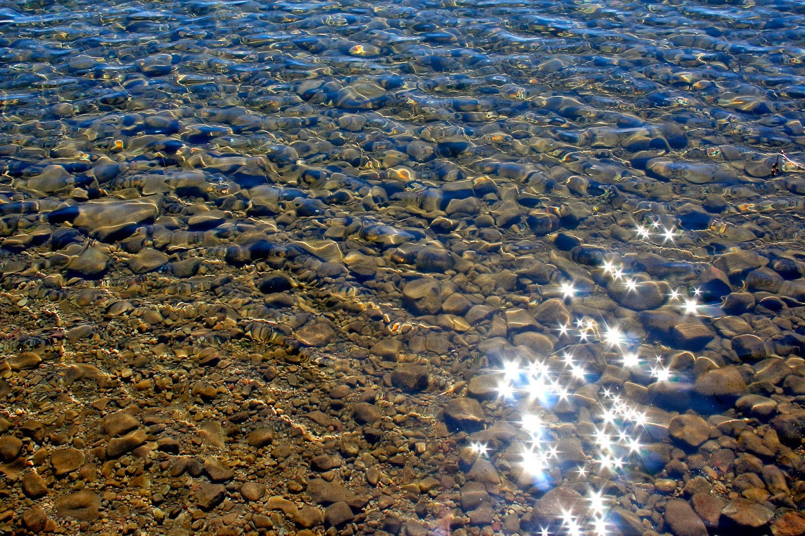
crystal clear water
enjoying the view
The trail was in pretty good condition. There were only a few blow downs that we had to navigate around.
one of the blow downs
a fungus among us
there are boardwalks along a lot of the trail
a cabin on the far side of the lake
rootball
a small waterfall running over fire red roots
hills on the other side of the lake
The worst part of the trail were the dozen or so snowfields we came across. About half of them were pretty sizable ones and we post-holed our way through them with only a minor injury.
bandana doubles as a wrist wrap
one of the deeper spots
a view of the snowbank from the other side of the lake
We completed the loop and decided to stop at a lake viewpoint for some lunch and sunbathing.
Diego in his throne
our lunch spot
We ended up spending about an hour just soaking up the sun on the bench before heading back to the car.
Diego enjoying the sun
On the way home, we stopped at the East Wind drive-in for an ice cream cone (we ended up waiting about 40 minutes for 10 minutes of tasty treat).
It was a nice outing that ended up more of a challenge than we anticipated.
We decided it was high time for us to explore another corner of our beautiful State and made plans to visit SE Oregon. After much research, I picked out the areas that looked most interesting and mapped it all out. Not knowing what to expect for drive times (since the road conditions really depend on how much rain occurs) I picked out enough places to visit that would give us more than enough to explore.
We left straight from work on Thursday evening around 530pm and drove straight to Hines, Or. It is a town just west of Burns. As we pulled into town, we noticed several deer right in peoples front yards.
We were going to stay at the rest stop for the night, but since we didn't get in until about 1130 pm, we decided to get a hotel room. In a quick internet search, we found a couple of options. The first one was full for the evening, so we went with the second choice: The Ryan & Rory Inn
We were pleasantly surprised with this Inn. It had great rates, allowed pets, had a comfortable bed and had a free hot breakfast in the morning (hello biscuits and gravy). It was quiet and close to the next highway we would be getting on in the morning.
April 4th
It was nice to take a hot shower in the morning after the long drive the night before. We were up, fed and on the road at 930 the next morning.
After a quick stop at the gas station and a stop at the Buzz N for some espresso, we headed south on the Frenchglen highway.
We enjoyed the occasional cloud breaks that would reveal views if the nearby Steens Mountains and other nearby hills and mountains.
We also were surprised that the area is a known stop for migratory birds this time of year. There were so many different birds, we were having a hard time keeping track of them all.
Cranes?
wide open roads
After about 20 miles, we decided to go west on an old dirt road that appeared to go up to a viewpoint. We explored the area for almost an hour.
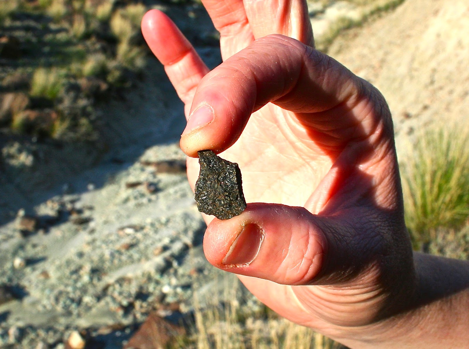
Discovering small animal bones, petrified wood, a little cave in a giant boulder and some nice views. Diego had a great time exploring around.
sunbathing puppy
romping
our first Subaru AD
look how strong I am ;)
peeking through the hole in the rock
As we headed back down to the highway, there were some flat spots along the side of the dirt road that were a little muddy, so I couldn't resist taking the Subie for a little romp in the mud. She had her first mud bath.
We headed on to our destination: Diamond Craters Outstanding Natural Area. At the Devine Canyon ash flow(just inside the craters area) we decided to pullover and make some lunch. Bacon, chicken and avocado sandwiches. YUM!! We did a little exploring in the field where we pulled off at after we ate and found some cool relics, took a few pics and continued on just after 1pm.
cool old stuff..just laying around
chicken, bacon and avocado sandwiches
tiny bones everywhere
look how buff my lady is ;)
HAPPY PUP
Malheur Maar
We explored the various crater areas and finished the loop around 4pm and then headed to the Pete French round barn.
There is a visitor center about 1/4 mile before the barn that we stopped in and picked up a bird ID book. Inside the center, there was also a museum with antiques from the owners (the Jenkins family) history.
round barn complete with a lookout raven
Thank You Cycle Oregon!!
By 5pm we were back on the road and heading towards Mann lake.
On the way, we encountered a decent rainstorm and were engulfed by the "big gay double rainbow of Harney county". It was a pretty impressive display. I was sure we were going to spot the pot of gold, but no such luck.
Mann Lake with the Steens mountains in the background
We arrived at Mann Lake just before 6pm. The lake is right at the foot of the Steens mountains.
We found a spot to park and made some dinner... Pizza pockets!!
Cher made up the bed while dinner was cooking. We opted to sit in the car for dinner as it was getting chilly and sprinkling. We turned in for the night around 8pm.
April 5th
We woke up around 645, made breakfast, packed up the car and by 9 were heading south toward the Alvord desert.
Just past the Alvord ranch, we spotted two antelope grazing in the sage brush. They didn't like us stopping to take pictures of them and quickly leapt off.
We stopped in at the Alvord Hot-springs for our morning "bath". By 945, we were skinny dipping in the Hot-springs as we enjoyed views of the Alvord desert to the east and the Steens mountains to the west.
We could have stayed here for the rest of the weekend
We were surprised that an hour past by while we were in the springs.
We dressed, went back to the car and had a snack and enjoyed the views.
At 11, we headed onto La Playa. As we headed into the dry, ancient lake bed, we drive cautiously making sure to stay away from darker areas that could be wet. We were warned that getting the mud in your tires would mean getting stuck. Luckily we didn't see any wet spots.
dust storm on the Alvord desert
We drove for about 3 miles on La Playa and stopped to get out. We saw an amazing dust storm in the distance.
We walked around for a bit and then headed back to the main road.
Just before noon we were in our way to the bustling metropolis of Rome, OR.
Rome turned out to be slightly less bustling than we thought, so we continued on to Jordan Valley. On the way, we crossed into the mountain time zone, so it was suddenly an hour later.
We got to Jordan Valley at about 145 and found a place to grab some lunch: the JV Cafe. Most of the patrons in the diner were truckers passing through.
After lunch, we stopped in the mini mart to grab a few things and then got back on the highway.
Beings we were only 16 miles from Idaho, we decided to stop at the state line for a quick pic and so we can say we were there.
just a quick stop in Idaho
We turned back to go up the road to Leslie Gulch, which we had passed about a mile back.
The road to Leslie Gulch is graveled and is an open range.
A few miles down the road, we encountered a herd of cows on the road. After spending a few minutes asking them for directions, we were begging to wonder how to coax them off the road so we could pass.
Apparently all it takes is snapping a picture... I guess they are camera shy. As soon as the camera clicked they all darted to the side of the road...Luckily they did because a car came zooming from the opposite direction.
you gotta keep an eye on the white faced cows ;)
As we continued on the gravel road, we came across a small "town", actually I'm not sure it could be considered a town, but there were a few clustered houses and a cut little school house that probably school the local K-12th graders.
Probably the smallest school in the state
At around 4pm, we arrived at the Leslie Gulch area. There is a large sign telling you that you have arrived as you cross a cattle grate. Then off to the other side, there is a smaller sign earring you that the road is the only way in or out of the area and to be prepared for flash flooding.
The narrow gravel road drops into the canyon as you continue on.
There are a few turn-offs on the way down that are trail-heads to hike some of the other gulches along the road.
At one of them, there was an old cabin. It looks like it is maintained and it actually appears to be a private cabin. Boy...that would be a nice place to have a cabin!!
beautiful landscapes
We eventually made our way to the Slocum Creek campground, which is just about 1/4 mile away from the Owyhee river (and the end of the road). There are about 9 campsites here and they all have covered picnic tables. There are also vaulted toilets. It was a pretty nice place.
one tired pup
After setting up camp and having dinner, we walked down the road to the river and explored around a little. We headed back to camp, enjoyed a fire for a bit and then turned in for the night.
perfect view to prepare breakfast to
April 6th
The next morning we woke up around 645. We enjoyed a tasty breakfast that consisted of corned beef hash and eggs, packed up the car and by 830 we were headed up Leslie Gulch.
On the way out, we stopped at Juniper Gulch to use the bathroom and explore around a little.
that hill was a lot higher than it looks!!
By 915, we were headed toward Succor Creek State Natural Area. The road from the Leslie Gulch junction to Succor Creek was a little rougher and winding. There were amazing views of the Succor Creek canyon. We stopped at a viewpoint about 1/2 mile south of SCNA, enjoying the views and took some photos.
everyone had a skull to display
we were right on the edge of a canyon here
We continued through SCNA and drove on to Adrian, OR. We arrived "in town" ...
...queue banjos...around 1130, grabbed some propane and ice and continued on.
Just after noon, we passed though Brogen Hill and were enjoying views of the mountain ranges to the west. Getting out to snap a pic of the beautiful range ahead, Cher was accosted by multiple tumbleweeds.
Around 1pm, we crossed the Blue Mtn summit and entered the Malheur National forest.
We stopped off at an old homestead we saw along the side of the road and explored for a bit...
Diego mak'n sure he smells "good"
There was an old coral, an old barn and a dilapidated house(in which the floor was covered in rat feces and the wood stove appeared to be a nice cozy rat nest.
At 2pm, we pulled off the HWY at a nice viewpoint of the Strawberry mountains. It was also a marker for the Oregon trail. There was a giant covered wagon with auto-tour info for people that were interested. We enjoyed some sandwiches for lunch and got back on the road.
wagons Ho!!!!
Strawberry mountains
Just before 3pm, we drove through Prairie City and stopped for some coffee at Roan Bean for some tasty caffeine treats.
Getting back on the road, we were get'n close to our destination for the night... The Fish House Inn in Dayville.
Of course just 10 miles from our destination, I would see flashing lights in the rear view mirror... After paying too much attention to the rancher tending to the cattle and not enough attention to the speed I was going, I managed to get pulled over... And here is the conversation:
State trooper: ma'am, I am pulling you over because you were going 16 miles over the speed limit. Are you aware of how fast you were going?
Me: no officer. I was checking out the cows and honestly wasn't paying attention to my speed.
I hand my license and registration to the officer.
10 minutes later the officer comes back.
Officer: ma'am... I'm just going to give you a warning today, but you need to realize... This isn't Portland. We have cows on the highway down here.
Me: thank you sir. I will pay more attention to my speed and less attention the the cows in the road.
Paying extra close attention to my speed, we shortly arrived at the campground.
The caretaker was nowhere to be found and we still had exploring to do. We decided to stake our spot and leave a few notes. By the time we took off, the caretaker showed up, we paid our fee for the spot and headed out for some late afternoon exploring.
We decided to visit the Sheep Rock unit of the John Day fossil beds. We had a few hours if sunlight left, so we stopped off at the Blue Basin overlook and the the Foree picnic area. On the way back to camp, we stopped off at the James Cant homestead(which was unfortunately closed, but we wandered around the grounds for a bit).
Sheep Rock
Juniper trees everywhere
So many bunbuns!!
By the time we got back to the campground, all of the RV spots had filled up and we were happy that we made our claim earlier.
We sat under the clear sky, that was filled with bright stars and moon, and enjoyed a delicious dinner of pasta with pesto, beer brats and cheese by lantern-light.
our quarters for the trip
dinner prep
romantic dinner by Black Orbit light
After dinner, we turned in for the evening.
Realizing how many people were at the campground, we set our alarms for early, so that we could have first crack at the bathrooms.
April 7th
We awoke at 6am, got showered and enjoyed our final breakfast on the road.
By 745, we were back on the road and headed to the Painted Hills unit of the John Day fossil beds.
Shortly after getting back on the road, we came across an interesting tree. We had to do a u-turn to grab some pics of the tree and in doing so, we discovered an old house.
this tree must provide some seriously good stuff ;)
A short time later, we were entering the Painted Hills unit. The road leading up to the Painted Hills is also an open range, so there were cows in random places along the way.
We stopped at the overlook for some pictures and then headed to the various trails further back.
Our first stop was the Painted Cove trail. You hike up to an overlook and then head back down and circle a red hill.
so many amazing hills with beautiful hills
On our way down from the overlook, we spotted a Jack rabbit the quickly jetted across the red hill... He obviously can't read all of the signs that state "Stay Off". As we circled the hill, we saw him a few more times.
There were a few wildflowers starting to come out
so many Jack Rabbits!!
Next we were on to the Leaf Fossil trail. It is a short little jaunt around a hill covered in hundreds if small white rocks. Apparently this spot has been a source of many of the fossils found in the area. The only thing we found was waste from an orange someone had been eating along the way.
Our final stop was the Red Hill trail. It was just a short trail to a viewpoint of... You guessed it: a red hill. It was pretty cool looking. I imagine it looks similar to the landscape on Mars.
We headed out and made a stop at the day use area at the beginning if the Painted Hills area. There are covered picnic tables and vaulted toilets for use.
We made use of the rest of the pizza pocket ingredients for lunch and enjoyed the sun for a bit before continuing on.
YUM!!
if he only had sun year round, he would be the happiest dog ever!!
We noticed a sign in the way out that said hiking was allowed in the areas outside of the actual Painted Hills unit. We pulled over and hiked around a bit near an unofficial painted hill.
Monsieur fox approves this trip!!
Since it was an open range, there were cow pies everywhere... And they were bigger than Diego.
It was just after 1 pm and about 75 degrees out, so we decided to hop back in the car and continue our way home.
About an hour later, we were in Prineville and decided to stop at the Tastee Freeze for some frozen treats.
By 4 pm, we were heading up the road to Timberline lodge. It was such a beautiful bluebird day, we had to stop for some pics of our beautiful lady and to pick up a new number sticker.
our beautiful lady revealing a little something-something
We headed on and stopped in Sandy for some dinner and were home by 645pm.
At first we were going to leave stuff, but needles up putting most everything away. And then we both collapsed in bed to dream of our whirlwind trip of the lower corner if our beautiful state.
We both had such a great time and already have ideas for things we'd like to do the next time we visit.
There are a few hikes in and around the Steens mountains that is like to do and all of them would include a post hike rest in the Alvord hotsprings.
I would also like to check out the Owyhee canyonlands that are south of HWY 95, as well as the Pillars of Rome and the Chalk Basin. I could also spend a lot of time just exploring the different gulches off of Leslie Gulch.
We would also like to spend some time checking out the Clarno unit of the John Day Fossil beds.